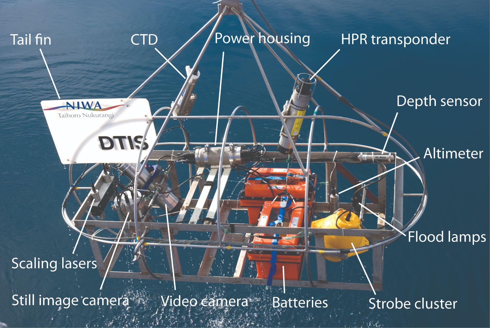
The Deep Towed Imaging System (DTIS) has been used in Aotearoa New Zealand since 2006 to take pictures and video of deep-sea biodiversity and seafloor habitats. This is essential to better understand potential ecosystem effects of fishing. It has high-definition still and video cameras, lights, strobes, laser pointers and batteries mounted in a rectangular frame. This frame is attached to the research vessel carrying it – often the RV Tangaroa – by a conducting wire. This wire allows the DTIS to communicate with the vessel, enabling researchers to see a live video feed, control its cameras and lights, and see information on depth and distance from the seabed. The DTIS runs in transects (or stripes) taking video continuously. The full length of each video transect is analysed and assessed for substrate (seabed) type, algae, benthic invertebrates (invertebrates which live on the seafloor), and fish. This sort of technology has not been widely deployed due to the ‘third wire’ restriction on commercial vessels, which was put in place to protect seabirds.[1] Because of the unintended consequence of the restriction, there are lots of lost opportunities to collect data and this has posed a barrier to innovation.
With the recent establishment of the Ross Sea Region MPA, it is no longer appropriate to carry out random trawl surveys in this region. Therefore a new survey method is required to monitor the status of rattails (grenadier), which are an important bycatch of the toothfish longline fishery within the Ross Sea. Comparing visual counts of rattail abundance from DTIS with results from acoustic and trawl surveys enables researchers to determine whether the DTIS is a possible alternative approach to monitor rattails.

The anatomy of the Deep Towed Imaging System (DTIS) camera system: the CTD (Conductivity, Temperature, Depth) records information about the temperature, depth, and salinity of the water DTIS passes through; the HPR transponder sends acoustic signals to the ship giving the position of DTIS; the altimeter measures how far DTIS is above the seabed, and the tail fin ensures that the unit moves in a consistent direction as it is towed by the ship. Image credit: Dave Bowden/NIWA.

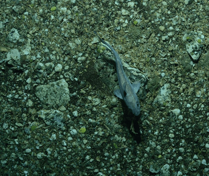
DTIS image of the rattail species the Caml grenadier (Macrourus caml) in the Ross Sea in 2019. Image credit: NIWA.

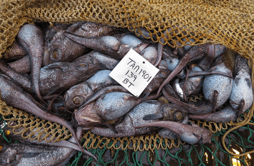
Associated trawl catch of rattails. Image credit: NIWA.
References and footnotes
[1] The use of net sonde cables, also known as ‘third wires’ (i.e. where a cable is hard wired to a trawl sonar attached to the net head rope to allow monitoring of the nest position and catch entering the net) have been prohibited in Aotearoa New Zealand waters by regulation since 2008 to prevent seabird mortalities because of observations that the third wire increased the risk of ‘warp strikes’, where seabirds run into the wire and are injured or killed. FNZ can grant (and has granted) special permits to trial gear with a third wire, with a requirement for observer coverage during trial.
